

CNN
—
Another potent storm is putting millions in the United States in harm’s way again, just days after a deadly, cross-country storm left a trail of destruction in its wake.
The storm isn’t a carbon copy of the last one, but it will once again spawn severe thunderstorms and its powerful winds could trigger fast-moving fires and a blizzard in the central US.
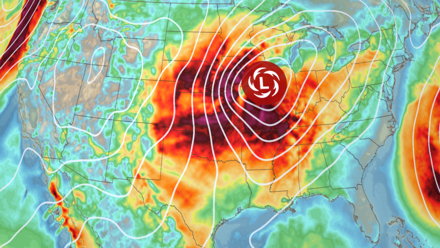
The storm started to come together in the Rockies Tuesday afternoon and will reach the Plains by night and strengthen considerably through Wednesday as it tracks into the Midwest. Its winds were already whipping up dangerous dust storms by late Tuesday morning.
Powerful wind will be the most widespread threat, and gusts stronger than 40 mph are possible over more than 1,300 miles from Texas to Minnesota Wednesday, capable of damaging trees and power lines.
‘Wildfire outbreak’ possible
The weather pattern in the US has been stuck in a loop since March began, so the risks involved in the upcoming storm will sound like a broken record.
Gusty winds were blowing over parts of the southern Rockies and Plains on Tuesday as the storm started to take shape. This ramped up the risk of wildfire spread to its highest level and for the Storm Prediction Center to warn of a “likely wildfire outbreak.”
A level 3-of-3 fire weather risk exists Tuesday for parts of New Mexico, Texas and Oklahoma from the SPC. Vegetation there is primed for ignition and spread, and widespread wind gusts up to 60 mph could turn any spark into an all-out blaze. A few gusts could approach 80 mph, especially in eastern New Mexico.
Gusty winds will keep the fire risk alive Wednesday and a level 2-of-3 fire weather risk is in place for parts of western and southern Texas where frequent gusts of 30 to 40 mph are likely in the afternoon. Stronger winds will blow farther north where the storm intensifies, but the greatest risk of wildfire spread will stay confined to tinder-dry areas of the southern Plains.
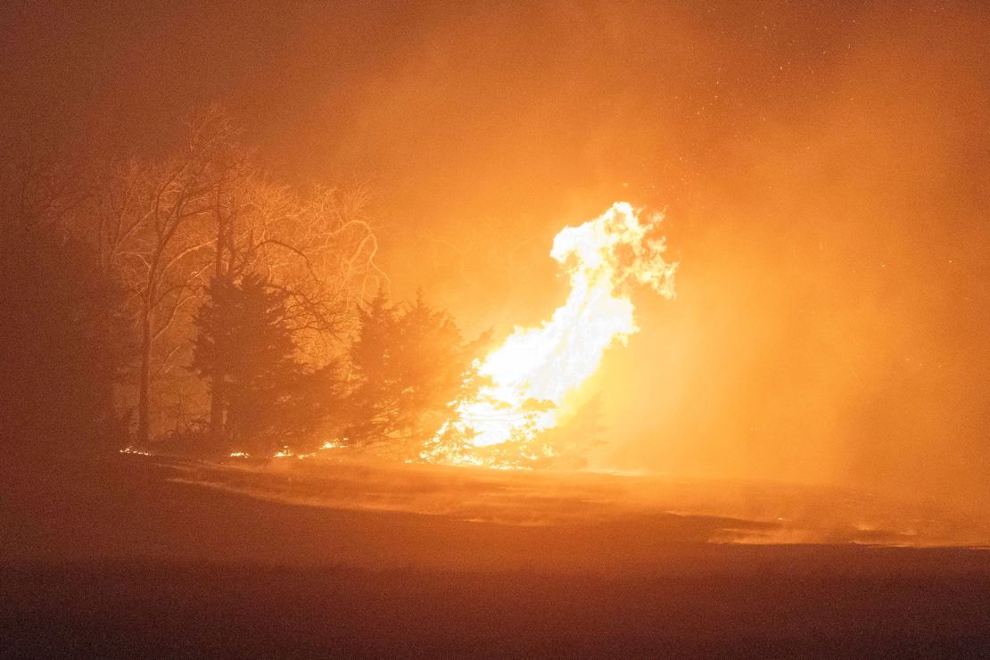
These renewed wildfire risks are happening after deadly fires broke out over the weekend.
More than 130 wildfires fueled by high winds from the last storm damaged at least 400 homes and killed four people in separate counties in Oklahoma, according to the state’s Department of Emergency Management.
Strong winds also started to kick up dirt and debris and create blinding dust storms Tuesday morning. Dust storm warnings were in effect for parts of at least three states – New Mexico, Texas and Kansas – by early Tuesday afternoon as gusts stronger than 50 mph roared there.
Dust storms make it incredibly hard to see more than a few feet and send air quality levels plummeting.
They also lead to very dangerous driving conditions. “There is no safe place on a highway when a dust storm hits,” the National Weather Service in El Paso, Texas, warned Tuesday.
At least eight people in Kansas and four people in Texas were killed in car crashes Friday when dust storms blotted out the sky and sent visibilities to near zero.
Blizzard conditions return
The storm will start dumping snow on parts of the Plains Tuesday night and over some of the Midwest by Wednesday morning. Spots caught under the heaviest snow from far eastern Nebraska to Michigan’s Upper Peninsula could get more than half a foot through Wednesday night.
A few inches of March snow aren’t typically enough to cause major disruptions in the Plains and Midwest, but add prolonged gusty winds to the equation and then there’s a problem.
Blizzards happen when snow and strong winds combine and create whiteout conditions for a few hours. Whiteout conditions — like dust storms — also make it incredibly hard to see more than a few feet ahead.
Whiteouts are possible even in spots where just an inch of snow falls because of the strength of Wednesday’s gusts — more than 50 mph in parts of Nebraska, Iowa and Minnesota.
Travel in blizzard conditions could be “treacherous and potentially life-threatening,” warned the National Weather Service in Des Moines, Iowa.
Thunderstorms could deliver damaging winds
Thunderstorms will rumble Wednesday from the Midwest to the Gulf Coast and some could become severe.
The severe thunderstorm threat is nowhere near as significant or widespread as the tornado outbreak spawned by this weekend’s deadly storm, but storms could hinder recovery efforts where people are trying to pick up the pieces and threaten some of the same areas impacted Friday.
Some thunderstorms will kick off Tuesday night in parts of the Midwest. Most storms won’t be severe, but a few, especially in Iowa, could dump hail into Wednesday morning.
Additional thunderstorms — some severe — will form Wednesday afternoon in parts of the Midwest, stretch through Tennessee and into parts of Mississippi and Alabama into the overnight. Strong wind gusts and hail are the main threats, but a tornado cannot be ruled out.