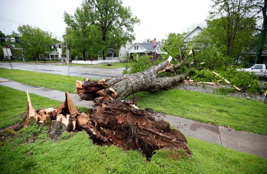
Another day of extreme weather is brewing in the United States Wednesday after violent storms roared through more than a dozen states on Tuesday and turned deadly, bringing hurricane-strength wind gusts, massive hail and tornadoes.
A derecho — a long-track storm with destructive winds — tore across the Midwest with wind gusts as high as 90 mph that ripped trees out of the rain-soaked soil and roofs off of several buildings. Some cities sustained notable damage, including the Pittsburgh area, where two people died.
Additional rounds of thunderstorms will slam the Plains throughout Wednesday and continue to ramp up an already serious flood threat.
Thunderstorms ongoing Wednesday morning in Texas and Oklahoma prompted severe thunderstorm warnings and more than 300 miles of continuous flash flood warnings from southeast of Lubbock, Texas, to southeast of Oklahoma City.
“Extensive flooding is occurring in many locations across the area with a couple more rounds of heavy rainfall possible this morning,” the National Weather Service in Norman, Oklahoma, warned early Wednesday. “As you’re heading out for your morning commute be sure to avoid flooded roadways, you never know how deep the water actually is!”
Portions of nearly a dozen state highways in Oklahoma were closed due to flooding Wednesday morning, according to the state’s department of transportation.
Heavy storms will continue throughout the day and eventually shift slightly farther east. A level 3-of-4 risk of flooding rainfall is in place for parts of Texas – including the Dallas-Fort Worth metroplex – Oklahoma and Arkansas, according to the Weather Prediction Center.
It’s been an extremely wet month for Oklahoma and deadly flooding has plagued the state in recent weeks. As of Wednesday morning, Oklahoma City has picked up nearly a foot of rain since the start of the month, marking it as the wettest April on record. The city normally gets less than 4 inches in April.
Flooding could quickly become life-threatening as rainfall totals continue to rise.
Multiple rounds of severe thunderstorms are possible in the Southern Plains Wednesday. A level 2-of-5 risk of severe thunderstorms is in place over much of the region and parts of the Mississippi Valley today, according to the Storm Prediction Center. These are some of the same areas that were hit by damaging storms Tuesday.
More than 5 million people in northeastern Texas – including Dallas – are under a level 3-of-5 risk of severe storms. Storms in the area could produce large hail, damaging wind gusts and tornadoes – some of which could be EF2 or greater – especially in the afternoon.
Derecho delivered hurricane-strength wind gusts Tuesday
Storms unleashed violent winds with gusts up to 90 mph across a path of more than 500 miles from eastern Indiana through much of Pennsylvania on Tuesday, leaving an extensive trail of damage in its wake.
A man in Pittsburgh was electrocuted by live wires from downed power lines Tuesday, the city’s public safety department reported. A second person was also killed in Allegheny County – where Pittsburgh is located – during the storms, according to a news release from the county’s emergency services, but additional details were not immediately available.
Allegheny County reported “multiple regional phone system disruptions” and briefly had 911 outages in the evening as a result of extensive power outages from the derecho.
At least two school districts outside Pittsburgh are closed on Wednesday and several others are delayed following reports of damage, according to CNN affiliate WTAE.
Triple-digit wind gust recorded in Texas as storms slammed the South
Parts of the Southern Plains and Mississippi Valley also got rocked by severe weather on Tuesday.
A powerful line of storms in southwestern Missouri Tuesday morning sent wind gusts up to 90 mph roaring through Springfield and produced a few brief tornadoes in nearby areas. Fierce winds brought down trees and power lines, leaving tens of thousands of homes and businesses without power by the afternoon.

Violent storms roared through Texas later Tuesday afternoon. A storm near Guthrie, Texas, in the northwest portion of the state, dropped massive hail up to 5 inches in diameter, which is bigger than a grapefruit.
About 60 miles east of Guthrie, a different storm produced a 106 mph wind gust near Seymour, Texas, just a couple hours later.
A wind gust that strong is more at home in a Category 1 or 2 hurricane and is the second triple-digit gust felt in western Texas in recent weeks.
CNN Meteorologist Monica Garrett, CNN’s Alex Stambaugh and Karina Tsui contributed to this report.

