CNN
—
Summerlike warmth has been eating away at fall in the United States this year as the season continues to wither in a warming world.
If you feel cheated out of crisp autumn weather this year, know you’re not alone. This fall is on pace to be one of, if not the warmest on record across the Lower 48, a CNN analysis of preliminary data from NOAA’s National Centers for Environmental Information shows.
The average temperature across the Lower 48 this fall is more than 7 degrees Fahrenheit above normal as of November 15. The warmest fall on record in 2016 was 4.04 degrees warmer than average. This fall will likely finish cooler than 7 degrees above normal with storms on the way this week, but it has still been the warmest start to fall on record.
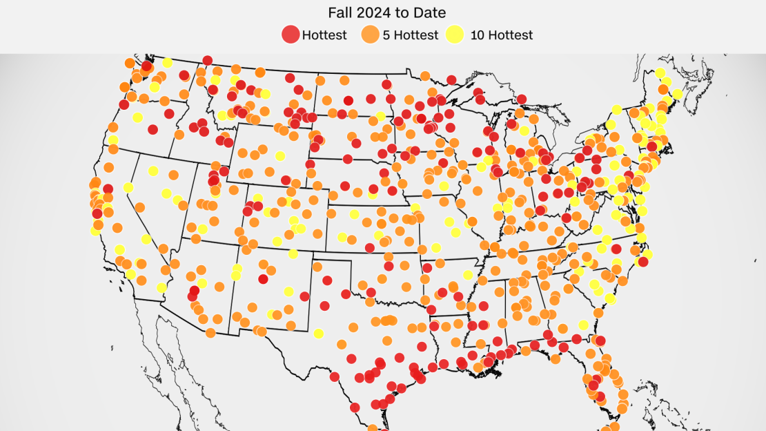
It’s been warm even when looking at specific cities and not the country as a whole. Hundreds of locales spanning every region of the continental US are experiencing one of the warmest falls to date, data from the Southeast Regional Climate Center shows.

“It’s not the fall weather of past generations,” said Shel Winkley, a meteorologist with the non-profit research group Climate Central. “Fall is not gone completely, but I think that this fall especially shows us that it is a shrinking season.”
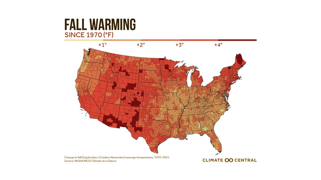
Fall has warmed by 2.5 degrees Fahrenheit on average since 1970 in the Lower 48, according to data from Climate Central. It’s happening faster in the Southwest and the Rockies, but every region of the country has warmed because of climate change.

Summer warmth is starting earlier during spring months and lasting later into the start of fall — eating away at both seasons, according to Winkley.
That’s exactly what happened this year. Summerlike heat dominated the first two months of the season in September and October, fueling the record pace.
Halloween is typically brisk for much of the Lower 48, but the holiday was unrecognizable for millions this year. Trick-or-treaters in much of the East, South and parts of the Midwest perspired in their costumes after high temperatures reached 80s during the day.
Prolonged heat and extremely dry weather have also been stuck in a loop where each factor continuously makes the other worse this season. The combination has resulted not just in record breaking temperatures, but also some of the worst drought conditions in two decades and destructive wildfires.
Without adequate rain and with persistent heat baking the ground, drought is impacting every Lower 48 state, according to the latest data from the US Drought Monitor.
Some states have experienced a flash drought, or when drought conditions become quite severe in a short timeframe. New Jersey is a prime example: The state had zero drought at the start of fall and now the entire state in at least moderate drought.
Whether this fall ends up as the warmest or one of the warmest depends on how the last two weeks of the season unfold — and at least a temporary pattern change is underway.
A series of storms will track across the Lower 48 this week and bring torrential rain to parts of the West, some wet weather to parched areas farther east and help make the weather finally feel like fall.
But it could be too little, too late. Some brief bouts of fall chill have managed to break through the unseasonable warmth, but it hasn’t been enough to change the season’s warm trajectory — a trend that seems like it will continue.

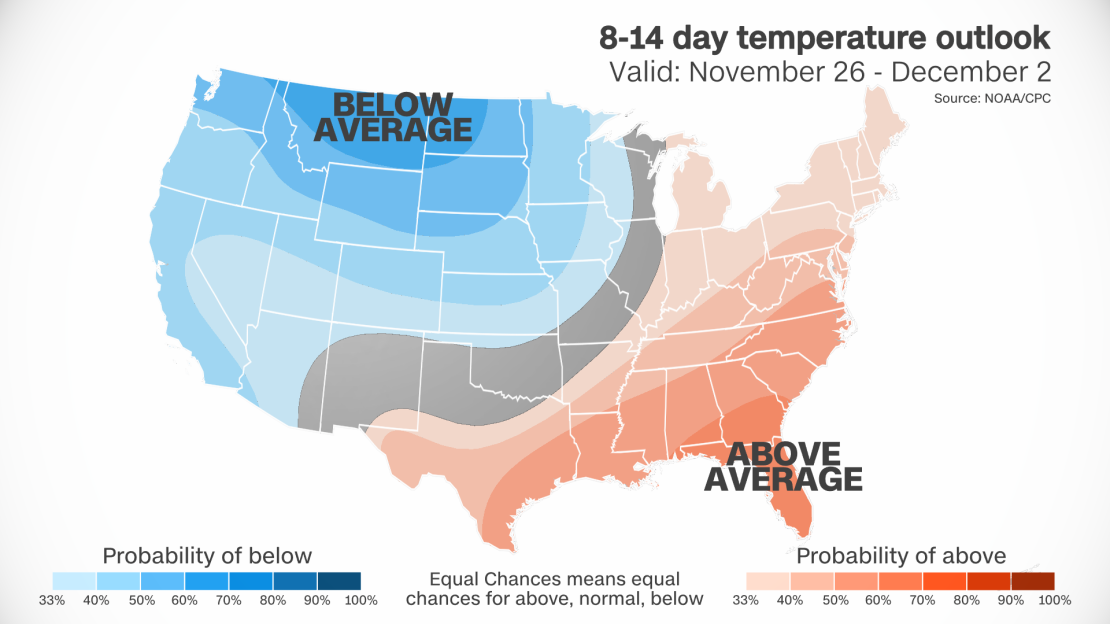
Forecasts from the Climate Prediction Center say above average warmth will linger for millions in the US through at least the end of November.


