CNN
—
A storm and the first punch of winterlike chill will combine to cause Thanksgiving travel headaches across the eastern half of the United States as Mother Nature serves up a smorgasbord of sloppy weather.
The storm will roll through parts of the Midwest and South Wednesday night and spread across the East on Thanksgiving Day. At the same time, frigid air will surge into the US like shoppers clamoring for Black Friday deals.
The storm’s exact track is still unclear and will dictate which areas receive holiday snow and which areas end up with a wet, dreary mess. But two scenarios are in play and in each there will be a disruptive storm for last second travelers.
Scenario one: A stronger, faster storm
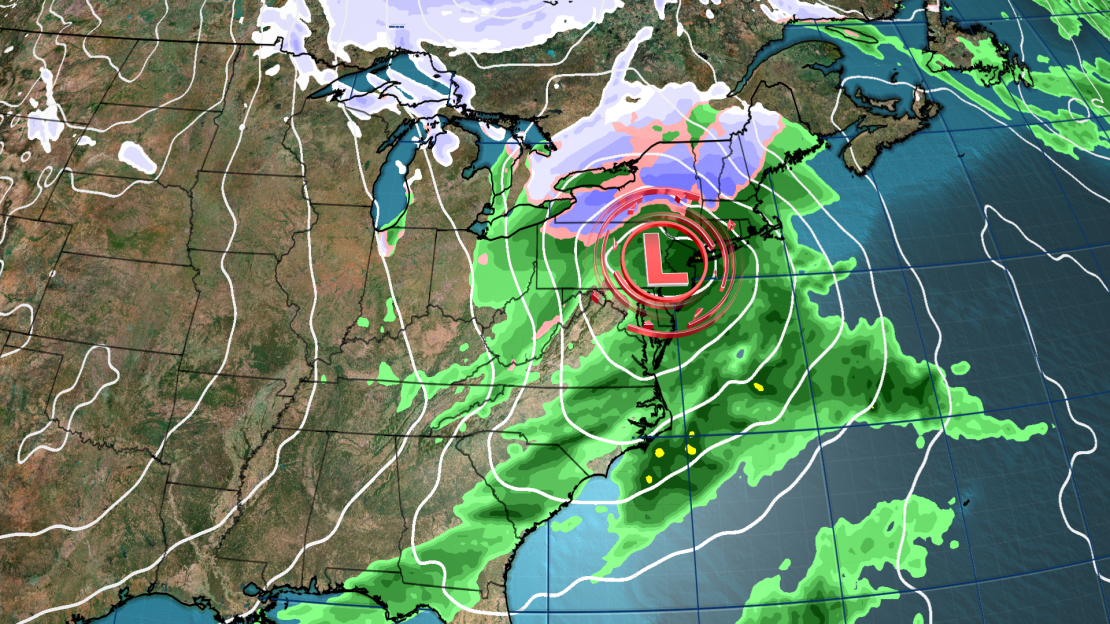
The first scenario would have a storm develop in the Plains Wednesday and strengthen as it heads east. It would become quite a potent force by Wednesday night as it spreads rain from the Midwest to the South.
It would take a turn to the northeast once it reaches the Appalachian Mountains and track along their spine Thursday, tapping into some cold, Canadian air before making a beeline for the New England Coast overnight.
This would deliver a round of heavy, wet snow to elevated areas of the interior Northeast Thursday while rain drenches lower elevations.

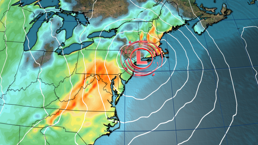
Wind speeds would also increase Thursday in the East with widespread gusts up to 30 mph possible. Higher gusts are possible for areas closer to the coast, especially from the Carolinas to southern New England.
Gusty winds could disrupt both air and road travel for truly last-minute travelers on Thanksgiving Day. The combination of wet weather and gusty winds could also bring down trees or power lines.
The storm would reach northern Maine by Friday morning and exit the US shortly thereafter. This would make for largely dry, but still breezy weather for the East for Friday and the weekend.
Scenario two: a weaker, slower storm
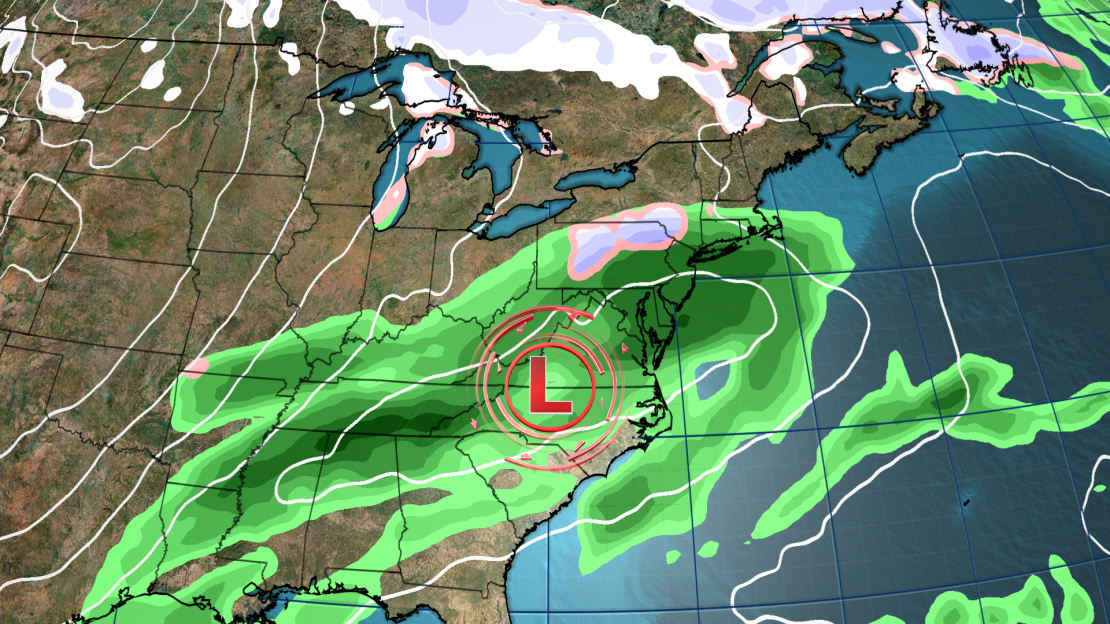
Another possible scenario would see the heaviest rain and risk for wet snow largely shift out of the Northeast and instead create a much wetter Thanksgiving for the mid-Atlantic.
The storm would develop late Wednesday night around the Mississippi or Tennessee valleys in this scenario. It would then slowly track through the mid-Atlantic through Thursday night and reach the Atlantic Friday morning.
This would bring more rain to the Southeast and mid-Atlantic Thursday while limiting chances for drenching rain and accumulating snow in the Northeast.

But how close to the coast the storm lingers once it reaches the Atlantic Friday will affect post-holiday travel.
A mix of rain and snow could develop in the Northeast and creep closer to the coast if the storm hugs the coast and tracks toward New England. This could make conditions a sloppy mess Friday at airports in the Boston area and for people traveling along the nearby Interstate-95 corridor.
Wet weather would be minimal for these areas if the storm tracks farther away from the coast Friday.
Coldest air of the season on the way
A widespread rush of cold, Canadian air is incoming for a huge part of the US, regardless of the late-week storm’s ultimate track.
Chilly air will start to filter into the northern states early this week before a significant push of winterlike air becomes widespread Thursday.
Chicago will struggle to reach the mid-30s on Thanksgiving Day — a temperature more appropriate for late December. Parts of North Dakota will barely reach the teens and will feel more like January.
Millions from coast to coast will be frigid by Friday.
High temperatures as far south as the Gulf Coast will likely be 10 or more degrees below normal and some locations might not reach the 60s.
Many locales in the central and eastern US will experience their coldest conditions so far this season over the weekend.
Philadelphia hasn’t recorded a high in the 30s since February but could come close both Saturday and Sunday. The same can be said of New York City.
The push of frigid air later this week will also flip the switch on the Great Lakes’ lake-effect snow machine. Cold, Canadian air rushing over the record-warm lakes will set the stage for lake-effect snow that could persist into next week for some areas.
Cold air will stick around for much of the East as the calendar flips to December and could last through the first week of the new month, according to forecasts from the Climate Prediction Center.


