CNN
—
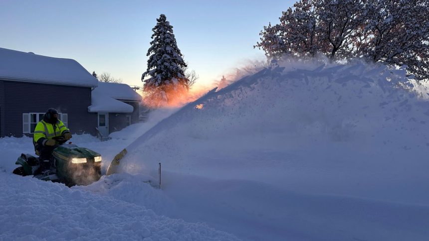
It’s still snowing in the Great Lakes after more than 5 feet fell over the holiday weekend and snarled travel, stranded motorists and buried homes. A short-lived break is coming before several inches of more snow and a blast of bone-chilling air arrive.
But first, an additional 1 foot of snow is possible through Tuesday in some of the same areas of the Great Lakes already blasted over the weekend as the current lake-effect snow event continues.
Lake-effect snow when cold air passes over relatively warmer lakes and happens as a series of narrow, but intense periods of snow — known as snow bands — that stream off of the lake and into an area close to it downwind. Snow totals can pile up when these snow bands train, or remain more stationary, over a particular area.
It can also reduce visibility and make for impossible driving conditions.
That was the case Monday afternoon in southwestern Michigan. More than a dozen vehicles were involved in a crash in intense lake-effect snow that brought near-whiteout conditions along Interstate 94 near Hartford, according to Michigan State Police. At least one driver was critically injured, police said. The road was closed in both directions.
Parts of far northwestern Pennsylvania and southwestern New York could pick up nearly 20 additional inches of snow through Tuesday. The most intense bouts of lake-effect snow will come to an end Tuesday, but some areas will only have about 24 hours or less to dig out before a storm sweeps through the region.
This fast-moving storm will bring several inches to much of the Great Lakes and parts of southern Canada starting early Wednesday before it swings through the Northeast on Thursday.
Snow totals from this storm won’t be nearly as significant as those from lake-effect snow over the holiday weekend. A few inches will likely accumulate from the Great Lakes through elevated areas of the Northeast with a sloppy mix of rain and snow for some lower elevations.
Lake-effect snow will start up again Thursday in the wake of the storm as another punch of frigid, January-like air engulfs the eastern US late this week.
It’s too soon to know exactly how much snow the next round of lake-effect has in store for the Great Lakes, but early forecasts are not nearly as extreme as those of the past weekend.
Nearly 70% of the United States –– roughly 220 million people –– should see temperatures reach or drop below freezing through next weekend.
Low temperatures will plummet back into the single digits or fall below zero over much of the north-central US and parts of the Midwest by Thursday morning. Temperatures will be below freezing almost everywhere in the Lower 48 Friday, with the exception of the West Coast and parts of the South.
Cold air rushing over relatively warm lakes is the same recipe that produced feet of lake-effect snow over the holiday weekend. Just over 65 inches fell in part of New York’s Tug Hill region — an area notorious for massive totals in lake-effect events.
“During lake-effect snow, the weather can vary from bands of locally heavy snow with greatly reduced visibilities to dry conditions just a few miles away,” the National Weather Service in Buffalo, New York, said. “Be prepared for rapid changes in weather, visibility, and road conditions.”
This weekend proved just how debilitating lake-effect snow is for travel.
Hundreds of travelers stranded
The most treacherous travel conditions happened after Thanksgiving, during some of the busiest travel days of the year.
New York State Police helped at least 110 disabled vehicles from parts of western New York to the Pennsylvania state line between Thanksgiving and Sunday, officials said in a news release.
New York Gov. Kathy Hochul declared a state of emergency in 11 counties as conditions quickly deteriorated Friday.
“My administration is working around the clock to respond to the snowstorm in Western New York and the North Country,” Hochul said on X Saturday. “Our state agencies and over 100 National Guard members are on the ground to support storm operations.”
Pennsylvania Gov. Josh Shapiro also called in his state’s National Guard on Saturday to assist stranded motorists and ensure emergency responders can reach anyone trapped, he said on X.
Pennsylvania State Police responded to nearly 200 road incidents over a 24-hour period on Friday and Saturday, according to Shapiro’s office.
In Erie, Pennsylvania, treacherous conditions on Sunday caused some of the city’s plow drivers to get stuck while removing snow, city officials said on Facebook.
North East, Pennsylvania, a borough in Erie County, recorded just over 42 inches of snow between Thursday night and Saturday afternoon while Erie received 31 inches. The New York town of Barnes Corners saw 46 inches of snow by Sunday morning.

“Yesterday, I shoveled for four hours and today I’ve been here for about an hour,” Erie native Richard Korytowski told CNN affiliate WICU over the weekend, as he dug out his driveway.
“I expected to shovel,” he said, “but not this much.”

In neighboring Ashtabula County, Ohio, resident Ashley Drew shared footage of a Conneaut home vanishing into a blanket of heavy snow Saturday, with its blue front door just partially visible as snow continued to fall.
Parts of the county, which sits on Lake Erie, recorded about 40 inches of snowfall through Sunday night.
About two feet of heavy snow also buried Orchard Park, New York, where the Buffalo Bills secured a 35-10 victory against the San Francisco 49ers Sunday night. Crews and volunteers had earlier assisted with removing snow from the field at the open-air Highmark Stadium.

CNN’s Lauren Mascarenhas, Gene Norman, Allison Chinchar, Elisa Raffa, Steve Almasy, Artemis Moshtaghian, Taylor Galgano and Sam Joseph contributed to this report.


